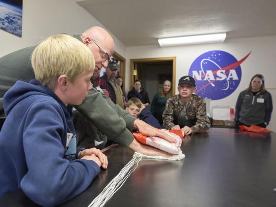
BOZEMAN – Science teacher Doree Thilmony jumped at the chance when she learned last fall that Montana State University could help her put on a summer camp to teach geospatial skills in her rural community.
“I teach drones, so I know they are used a lot for mapping,” said Thilmony, the science teacher at Thompson Falls High School. “I wanted to teach not just how to fly drones but what they’re used for. I wanted the students to know about related careers.”
Thompson Falls was one of eight rural Montana sites that received grant funding to host the Geospatial Skills Camp for youth earlier this month, which included a follow-up opportunity to travel to MSU on June 18 for GIS Day. The camp was made possible by an $85,000 grant from the Air Force Office of Scientific Research and was sponsored by MSU’s Science Math Resource Center and Department of Earth Sciences.
GIS, or geographic information system technology, integrates geographic data from maps, satellite images, aerial photographs, GPS data, demographic information and environmental data to be used in analysis and decision-making.
Thilmony said the 12 students who participated in the Thompson Falls camp finished the week with a better understanding of how GIS is “used everywhere,” including in their remote corner of northwest Montana.
The MSU team developed the curriculum and provided 40 hours’ worth of educational material, including daily video presentations by MSU speakers from the Optical Technology Center, Montana NSF EPSCoR and the Center for American Indian and Rural Health Equity. Representatives from the U.S. Geological Survey, NASA and the National Weather Service also gave virtual lectures.
Time was allowed daily for camp leaders in each community to customize the camps.
“They told us to make it personal to our community, and that was important,” said Thilmony, who recruited as guest speakers a local meteorologist and forester to talk to students about how they use GIS technologies in their work.
While the Thompson Falls students were hearing how geospatial technology assists industries in their area, campers 600 miles away in the southeast Montana community of Broadus were learning how ranchers there use GIS to collect data and create maps that help with their decision-making and how they use drones.
“The practical applications for agriculture throughout the week were really highlighted,” said Powder River County Extension agent Mary Rumph, one of the leaders of the Broadus camp, which enrolled nine campers from four southeast Montana counties. “It was impressive for students to visit different sites and tie what they saw into the lectures.”
MSU alumnus and microbiologist Elliott Barnhart was one of the Broadus camp’s guest speakers. Rumph said the former Bobcat football player is a native of Powder River County and something of a local celebrity, so the campers were very engaged as he explained how he incorporates GIS into his work as a research hydrologist for the USGS in Helena.
Broadus eighth-grader Michael Stephens said his favorite activity during camp week was refining his drone skills. He also described how, with his newly acquired mapping and data-collection knowledge, he was able to map the grasshopper population on his family’s ranch. Now he is planning to create another map of the property’s fence lines.
Stephens was one of five Broadus campers who traveled to Bozeman for GIS Day, which included drone demonstrations, collecting data in the campus’ underground utility tunnels, and learning about potential career pathways and associated MSU fields of study. Students also heard about related MSU research, such as a project by assistant professors Eric Sproles and Katey Plymesser to help calibrate NASA’s Surface Water and Ocean Topography satellite.
Stephens said his favorite part of the trip was visiting with Montana Space Grant Consortium BOREALIS program interns, who described how they design and fly high-altitude balloons for scientific research.
“I liked learning everything that’s happening in ballooning,” said Stephens, who is involved in the 4-H aerospace program and aspires to attempt photography from a high-altitude balloon.
Lane Thilmony, an eighth-grader from Thompson Falls, said GIS Day and the prior week’s camp experiences sparked his interest in possible GIS-related careers.
“I liked making new connections and getting to meet cool people with cool jobs,” he said.
The offering was part of MSU’s ongoing efforts to provide opportunities for middle school and high school students interested in science, technology, engineering and mathematics, or STEM, fields. In addition to Thompson Falls and Broadus, camps were held in Ronan, Kalispell, Pryor, Sidney and White Sulphur Springs

